The Latest Updates, Perspectives and Stories From MatrixSpace
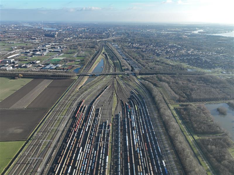
Railyards and rail lines face significant challenges daily—from theft, vandalism, and costly derailments. Technology enables securing their perimeters more effectively while also improve asset inspection practices.

The recent New Jersey drone panic has made it clear: people want to know what’s flying in low altitude airspace. Why can’t we provide the level of clarity demanded? What’s needed to make it happen?

While some industry influencers argue DFR operations are best run up to 200 feet above ground under shielded conditions (only), we explore the risks of this practice as well as the benefits of extending operational altitude with airspace sensors.

MatrixSpace has been named a third place winner in the Enabling Components & Peripherals category of the XCELLENCE Awards by the Association for Uncrewed Vehicles Systems International (AUVSI).

MatrixSpace, a U.S. radar and AI sensing company, has set about re-imagining radar with its MatrixSpace Radar.

Dan leads development for RF and radar systems and holds advisory roles across the industry, accelerating the development of integrated RF products.

We’ve grown up seeing the profound impact that personal computing and smartphones have made in our everyday lives. This was made possible by two megatrends.

Attending AUVSI XPONENTIAL 2023? In addition to our booth #3110 we’re also hosting a dynamic panel discussion The Next Frontier – Autonomy and Edge Sensing.

We’ve just learnt MatrixSpace is a finalist in the AUVSI’s XCELLENCE Awards 2023 for “Xcellence in Technology – Enabling Components & Peripherals”! This is very exciting.

What if drones could provide public safety teams with detailed info ahead of scene arrival, for informed decisions faster? Meet Drone As First Responder (DFR) programs.

Dan brings a formidable track record to the MatrixSpace team. He leads development for RF and radar systems and holds advisory roles across the industry, accelerating the development of RF integration into integrated circuit products.

The application of intelligent sensing is a hot topic, with innovators and researchers continuously breaking new ground. Artificial Intelligence (AI) is a big thrust behind these new sensor developments.
Latest News


PSPD in the city of Palm Springs, California, will utilize MatrixSpace’s low airspace awareness technology to expand the DFR program to cover an area of 37 square miles (95.8km2). This area equates to approximately a third of the city’s total area. Palm Springs now features a network of MatrixSpace 360 Radars, allowing a single PSPD pilot to remotely operate drones from three launch locations across the city. Two more drone launch sites are planned.

MatrixSpace has announced that the Palm Springs Police Department (PSPD) has expanded its Drone as First Responder (DFR) program, establishing the largest first responder agency coverage area (37 square miles) monitored by radar sensors instead of humans in the United States.

MatrixSpace has announced that the Palm Springs Police Department (PSPD) has expanded its Drone as First Responder (DFR) program, establishing a responder agency coverage area of 37 square miles monitored by radar sensors instead of humans. According to the company, the PSPD’s program expansion was made possible with multiple remote drone launch points across Palm Springs utilizing MatrixSpace’s low airspace awareness technology. This has also supported the city’s application for an FAA No Visual Observer flight operations waiver to ensure the safe separation and avoidance of both general aviation and commercial aircraft.

MatrixSpace, an intelligent sensor innovator, announced that the Palm Springs Police Department (PSPD) has expanded its Drone as First Responder (DFR) program, establishing the largest first responder agency coverage area (37 square miles) monitored by radar sensors instead of humans in the United States.

MatrixSpace, an intelligent sensor innovator, announced that the Palm Springs Police Department (PSPD) has expanded its Drone as First Responder (DFR) program, establishing the largest first responder agency coverage area (37 square miles) monitored by radar sensors instead of humans in the United States.