The Latest Updates, Perspectives and Stories From MatrixSpace
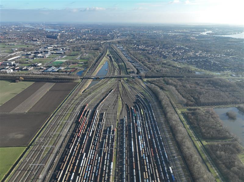
Railyards and rail lines face significant challenges daily—from theft, vandalism, and costly derailments. Technology enables securing their perimeters more effectively while also improve asset inspection practices.

The recent New Jersey drone panic has made it clear: people want to know what’s flying in low altitude airspace. Why can’t we provide the level of clarity demanded? What’s needed to make it happen?

While some industry influencers argue DFR operations are best run up to 200 feet above ground under shielded conditions (only), we explore the risks of this practice as well as the benefits of extending operational altitude with airspace sensors.
Railyards and rail lines face significant challenges daily—from theft, vandalism, and costly derailments. Technology enables securing their perimeters more effectively while also improve asset inspection practices.
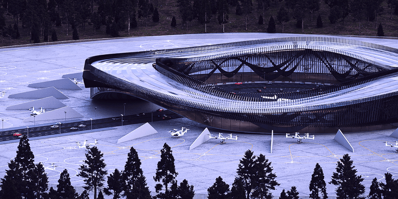
We recently announced a joint venture with Skyway to advance the integration of intelligent air traffic management and uncrewed aircraft detection systems. Skyway develops vertiports and provides advanced solutions for vertiport traffic management and unmanned airspace planning. MatrixSpace provides outdoor sensor solutions leveraging radar technology for use in defense and commercial applications, which addresses this need. The companies’ partnership is intended to support several aspects of enabling practical advanced air mobility (AAM) initiatives in the United States.
The recent New Jersey drone panic has made it clear: people want to know what’s flying in low altitude airspace. Why can’t we provide the level of clarity demanded? What’s needed to make it happen?
While some industry influencers argue DFR operations are best run up to 200 feet above ground under shielded conditions (only), we explore the risks of this practice as well as the benefits of extending operational altitude with airspace sensors.
L3Harris recently collaborated with MatrixSpace to demonstrate how the companies’ novel technologies can be combined to provide a ground-breaking, low-cost solution to detecting, identifying, and tracking drones.

Expanding its pioneering Drone as First Responder (DFR) program, Campbell…

Nautical ports have historically been the primary means for large volumes of cargo and people, including intercoastal shipping from local ports or from ports across the world.

In the ever-evolving landscape of prison security, the advent of drone technology has introduced new challenges.

While there’s a lot of attention given to drone detection and counter drone solutions, we also hear from customers about the need for higher levels of ground and air surveillance in the general aviation space.
Latest News


PSPD in the city of Palm Springs, California, will utilize MatrixSpace’s low airspace awareness technology to expand the DFR program to cover an area of 37 square miles (95.8km2). This area equates to approximately a third of the city’s total area. Palm Springs now features a network of MatrixSpace 360 Radars, allowing a single PSPD pilot to remotely operate drones from three launch locations across the city. Two more drone launch sites are planned.

MatrixSpace has announced that the Palm Springs Police Department (PSPD) has expanded its Drone as First Responder (DFR) program, establishing the largest first responder agency coverage area (37 square miles) monitored by radar sensors instead of humans in the United States.

MatrixSpace has announced that the Palm Springs Police Department (PSPD) has expanded its Drone as First Responder (DFR) program, establishing a responder agency coverage area of 37 square miles monitored by radar sensors instead of humans. According to the company, the PSPD’s program expansion was made possible with multiple remote drone launch points across Palm Springs utilizing MatrixSpace’s low airspace awareness technology. This has also supported the city’s application for an FAA No Visual Observer flight operations waiver to ensure the safe separation and avoidance of both general aviation and commercial aircraft.

MatrixSpace, an intelligent sensor innovator, announced that the Palm Springs Police Department (PSPD) has expanded its Drone as First Responder (DFR) program, establishing the largest first responder agency coverage area (37 square miles) monitored by radar sensors instead of humans in the United States.

MatrixSpace, an intelligent sensor innovator, announced that the Palm Springs Police Department (PSPD) has expanded its Drone as First Responder (DFR) program, establishing the largest first responder agency coverage area (37 square miles) monitored by radar sensors instead of humans in the United States.